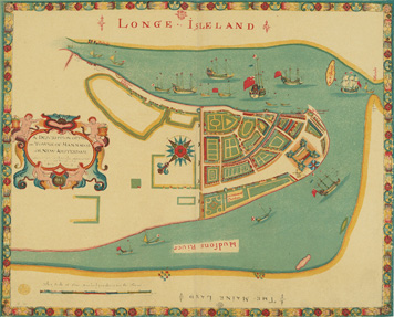
Images from Columbia University Libraries 2008 electronic publication of:
Stokes, I. N. Phelps. The iconography of Manhattan Island, 1498-1909. Vols. 1-6. New York : Robert H. Dodd, 1915-1928
To view the complete electronic edition click on the links below:
Vol. 1
Vol. 2
Vol. 3
Vol. 4
Vol. 5
Vol. 6
Exhibit Curator
Libraries Digital Program DivisionVolume 1»
Chapter 1: The Period of Discovery (1524-1609); The Dutch Period (1609-1664)
Chapter 2: The English Period (1664-1763)
Chapter 3: The Revolutionary Period (1763-1783)
Chapter 4: Period of Adjustment and Reconstruction; New York as the State and Federal Capital (1783-1811)
Volume 2»
Frontispiece
Section 1: Cartography
Addenda
The Minuit Maps, the Manatus Maps, the Castello Plan, etc. - Part of an Important Series of Maps, Plans, and Views, of the Dutch Colonial Possessions in the Second and Third Quarters of the Seventeenth Century
Section 4: The Dutch Grants
Section 6: Plan of Manhattan Island in 1908 - Showing Streets, Buildings, Dimensions, Elevations above High Water, etc.
Volume 3»
Frontispieces
Chapter 5: The War of 1812 (1812 - 1815)
Chapter 6: Period of Industrial and Educational Development (1842 - 1860)
Chapter 7: The Civil War (1861 - 1865); Period of Political and Social Development (1865 - 1876)
Chapter 8: The Modern City and Island (1876 - 1909)
Landmark Map
Addenda Plates
Volume 4»
Frontispiece
Chapter 2: The English Period (1664 - 1763)
Chapter 3: The Revolutionary Period (1763 - 1783), Part I (1763 - 1776)
Volume 5»
Frontispieces
Chapter 3: The Revolutionary Period (1763 - 1776 - 1783), Part 2 (1776 - 1783)
Chapter 4: Period of Adjustment and Reconstruction; New York as the State and Federal Government (1783 - 1811)
Chapter 5A: The War of 1812 (1812 - 1815)
Chapter 8: The Modern City and Island (1876 - 1909)
Volume 6»
Frontispieces
Chronology: Addenda
Original Grants and Farms
Bibliography
Bookmark this page as: http://www.columbia.edu/cgi-bin/cul/resolve?lweb0138
